
Modelling temporal and spatial variability in light availability in agroforestry systems
Oral presentation – EURAF2024 – 28-31 May 2024 – Brno Tom De Swaef1, Willem Coudron1,2, Peter Lootens1, Toon Baeyens3, Paul Pardon1, Bert Reubens1,Sanne Van Den Berge4, Pieter De Frenne2, Kris Verheyen21 Plant Science Unit, Research Institute for Agriculture, Fisheries and Food (ILVO), Melle, Belgium2 Forest & Nature Lab, Department of Environment, Ghent University, Gontrode, Belgium3 Department of Applied Mathematics, Computer Science and Statistics, Ghent University, Ghent, Belgium4 Bos+ Vlaanderen VZW, Gontrode, Belgium Agroforestry systems bring many biodiversity and functional benefits to agricultural systems and landscapes. For a broader implementation of agroforestry systems, accessible tools need to be developed to…
Oral presentation – EURAF2024 – 28-31 May 2024 – Brno
Tom De Swaef1, Willem Coudron1,2, Peter Lootens1, Toon Baeyens3, Paul Pardon1, Bert Reubens1,
Sanne Van Den Berge4, Pieter De Frenne2, Kris Verheyen2
1 Plant Science Unit, Research Institute for Agriculture, Fisheries and Food (ILVO), Melle, Belgium
2 Forest & Nature Lab, Department of Environment, Ghent University, Gontrode, Belgium
3 Department of Applied Mathematics, Computer Science and Statistics, Ghent University, Ghent, Belgium
4 Bos+ Vlaanderen VZW, Gontrode, Belgium
Agroforestry systems bring many biodiversity and functional benefits to agricultural systems and landscapes. For a broader implementation of agroforestry systems, accessible tools need to be developed to facilitate research, design and implementation of agroforestry into our agricultural systems. One of the
key aspects of agroforestry systems, at least in alley cropping systems, is the competition for light between tree rows and the crop. This competition for light (in combination with water) typically reduces crop yield closer to the tree rows (Pardon et al. 2018). Because tree rows induce a spatial heterogeneity in the crop, crop management in agroforestry systems would benefit from a precision agriculture approach. This way, fertilizer, varieties or species, sowing densities, etc. could be varied along management zones, and result in a better overall performance of the system. To define such management zones, the spatial heterogeneity needs to be mapped appropriately.
Here we present an intuitive modelling tool to simulate light availability in AF systems based on detailed LiDAR scans of trees. The tool allows the user to generate a 3D mock-up of an agroforestry set-up
(Figure 1) using preloaded trees or after uploading customized tree shapes generated from LiDAR scans.
From this mock-up, the tool can calculate the spatial distribution of the light transmitted to the crop. These data can then be further processed using functionalities that will become available via an R package. We showcase the potential of this framework by quantifying spatiotemporal light availability in North-South oriented alley cropping systems with trees of different species (Quercus robur, Betula pendula and Alnus glutinosa), ages and phenology. Our tool is freely available on https://agroforestry.ugent.be and can help farmers, advisors and other stakeholders to design agroforestry fields with a minimum of light competition.
Furthermore, it allows to delineate zones that can be managed differently in terms of fertilizer application
or variety choice.
Conclusion
For the development of INTACT, it was important to create an interactive and user-friendly tool that assists in considering the majority of aspects of investment and maintenance costs, as well as expected income from trees and shrubs in an agroforestry system. In this way, INTACT aims to support farmers online by offering a clear framework of costs and benefits that are relevant to trees, i.e. crucial elements in new agroforestry projects. After INTACT 1.0 is launched, more research will be conducted to test INTACT’s accuracy with realized agroforestry plans and to further improve user-friendliness.
Acknowledgement
The DigitAF project is supported by the European Union Horizon programme (101059794).
Keywords
microclimate, online tool, modelling, light availability, Online User Interface, shade, LIDAR
Bibliography
– Pardon P, Reubens B, Mertens J, Verheyen K, De Frenne P, De Smet G, Van Waes C, Reheul D (2018) Effects of temperate agroforestry on yield and quality of different arable intercrops. Agricult Syst 166, 135–151. https://doi.org/10.1016/j.agsy.2018.08.008
More info about the oral presentation related to this abstract to come
Want to know more about this presentation? contact@digitaf.eu
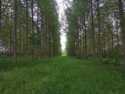
Old silvoarable site at Etonbury Wood (Bedford) – United Kingdom
by Vandendriessche, Jari (2024)
Full resolution and source to cite: https://www.doi.org/10.5281/zenodo.13835247