
From LUCIM to the LPIS Sustainability Compass: a new digital tool to support agroforestry
The DigitAF project is proud to introduce the LPIS Sustainability Compass, a new module integrated into the LUCIM (Land Use Change Interactive Map) platform. From AGROMIX to DigitAF Originally developed in the AGROMIX project, LUCIM was designed to explore land use change and highlight where agroforestry could bring resilience and climate benefits. Building on this foundation, DigitAF has extended LUCIM by adding the LPIS Sustainability Compass – a tool that links parcel-level data from the Land Parcel Identification System (LPIS) with European satellite information. What is LPIS and why does it matter? The LPIS (Land Parcel Identification System) is…
The DigitAF project is proud to introduce the LPIS Sustainability Compass, a new module integrated into the LUCIM (Land Use Change Interactive Map) platform.
From AGROMIX to DigitAF
Originally developed in the AGROMIX project, LUCIM was designed to explore land use change and highlight where agroforestry could bring resilience and climate benefits. Building on this foundation, DigitAF has extended LUCIM by adding the LPIS Sustainability Compass – a tool that links parcel-level data from the Land Parcel Identification System (LPIS) with European satellite information.
What is LPIS and why does it matter?
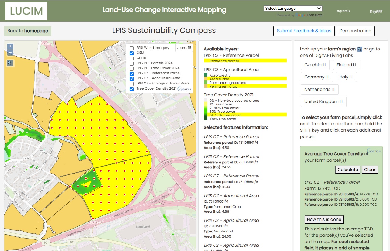
The LPIS (Land Parcel Identification System) is the European database farmers use to declare their land under the Common Agricultural Policy (CAP). It provides information on parcel boundaries, crops, and land uses – crucial for monitoring CAP rules and for designing agroforestry-supportive policies.
Until now, this wealth of information was not always easily accessible for farmers or policymakers. The LPIS Sustainability Compass makes it possible to extract meaningful insights directly from LPIS data and combine them with other datasets.
Adding the Copernicus advantage
Thanks to Copernicus, the EU’s Earth Observation programme, the tool integrates free satellite data on tree cover, land cover and environmental indicators. This allows users to:
🌍 Analyse land use at parcel and farm level
🌳 Identify tree-rich vs. tree-poor farms
📊 Detect land classification inconsistencies relevant for CAP compliance
🤝 Support evidence-based decision making for farmers, advisors and policymakers
Tested in DigitAF Living Labs
The tool has been co-designed and tested in DigitAF Living Labs across Europe, ensuring that it reflects the real needs of practitioners and policy actors. Feedback from farmers and stakeholders will continue to shape future improvements.
Open source and evolving
The LPIS Sustainability Compass is open access and available for anyone to explore. It will continue to evolve with stakeholder feedback and will ultimately be hosted directly on the DigitAF website.
👉 Try the tool here: https://mvagroecology.github.io/lucim/
📄 Read the full deliverable on Zenodo: https://doi.org/10.5281/zenodo.15609504